DESTRUCTIVE
AI GURUS
← BACK TO HOME

TigerLine

Stop renting maps. Stand up your own GIS infrastructure from authoritative public-domain sources.

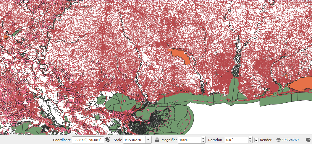
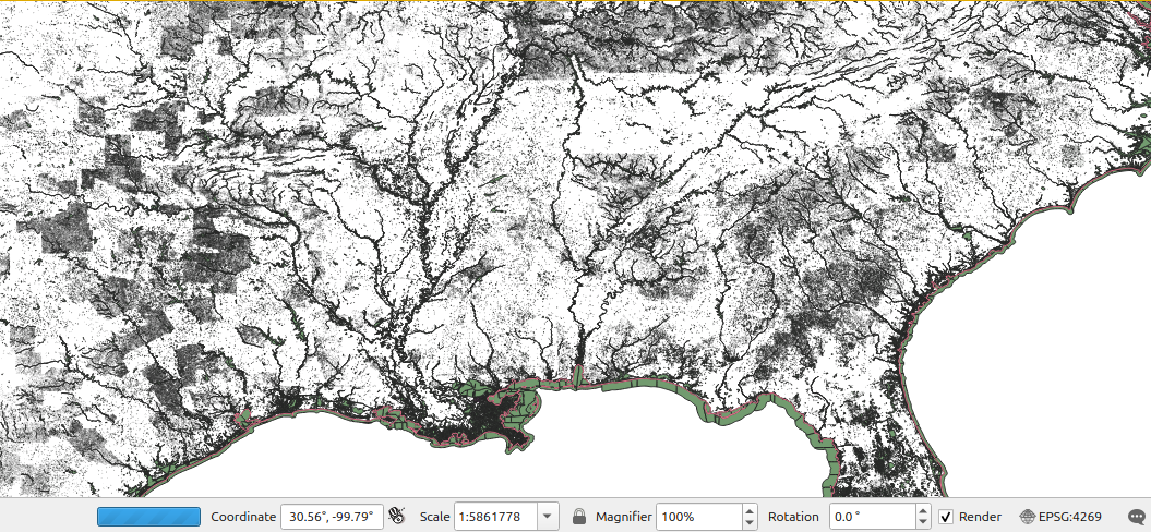
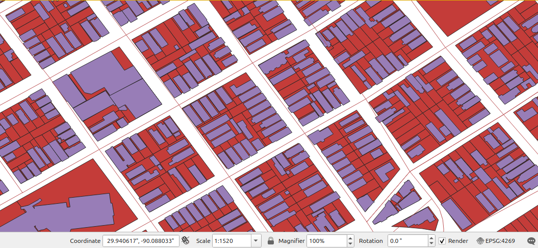
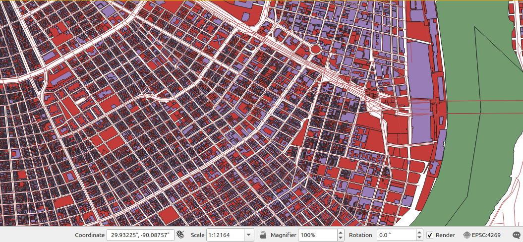
TigerLine is a working PostGIS database that ingests any geospatial source you can point at it — agency portals, municipal eGIS, Socrata endpoints, ArcGIS REST services, raster tile indexes, FTP dumps, Shapefiles on a thumb drive. The current build curates US Census TIGER/Line, USGS, NOAA, FEMA, USACE, MassGIS, NOLA municipal data, NRHP, and a growing list of others into a single queryable spatial backend. No tile fees. No external API rate limits. Your roads, your parcels, your routing, your tiles — on your hardware.

34
Schemas
49 GB
TIGER/Line 2025
742
Raster tiles indexed
147K
Walkable edges
// QGIS · NOLA PARCELS · LIVE FROM POSTGIS
New Orleans parcels overlaid on coastal wetlands rendered from TigerLine PostGIS

Eight things your private GIS can answer about any point on a map.

TigerLine isn't a generic map server — it's a queryable spatial database where every administrative polygon, every road segment, every parcel, every flood zone, every hydrography line is indexed and joinable. Ask it questions in SQL.

PostGIS Backend
PostgreSQL 16 + PostGIS 3.6 + pgRouting 4.0 + postgis_tiger_geocoder. 34 schemas, 200+ tables, full SQL access. Spatial indexes on every geometry column.
Walking + Driving Routes
pgRouting on the EDGES topology. Walking router on Salem (85K edges) + NOLA (147K edges + 48K nodes). TSP tour optimization cut a 6-stop loop from 2,570m to 1,757m.
Geocoding Both Ways
Address ↔ coordinate via the postgis_tiger_geocoder. State, county, place, ZCTA, school district, congressional district lookup from any point.
Vector Tile Output
MBTiles generation by city / county / state. Salem ships 74 MB (8 layers, z10–16). NOLA ships 125 MB (12 layers). Drop into any offline app, no tile-server runtime.
Cross-Source Joins
TIGER ⋈ ACS demographics ⋈ EPA facilities ⋈ CDC SVI ⋈ FEMA flood ⋈ NOAA surge ⋈ NRHP historic. One query, multi-agency answers.
Hazard & Resilience Layers
FEMA NFHL flood zones (130K LA polygons), NOAA SLOSH MOM Cat 1–5 storm surge envelopes (32K polygons), USACE levees + floodwalls + leveed areas, IBTrACS storm tracks (Katrina, Ida, Camille, Andrew).
Demographics On Tap
Census ACS 2023 5-year (1,388 LA tracts + 4,294 block groups), CDC SVI 2022, EPA ECHO Exporter (73K LA facilities). Spatial joins against any boundary.
Raster Index
742 raster & chart files (~58 GB) indexed out-of-database: USGS 3DEP DEM 1/3″ + 1m, NOAA SLR DEM, historical topographic 1891–1999, NOAA ENC nautical charts, SLOSH MOM.

Whatever the source, we can ingest it.

The list below is the current state of our reference build — not a ceiling. If your engagement needs a different state, a different agency, a municipal eGIS portal, an ArcGIS REST endpoint, a Socrata feed, an FTP dump, a quarterly Shapefile drop, or a flat CSV with a lat/lon column — we wire it in. Public-domain, CC-licensed, agency-permitted, or your own private data: same pipeline, same PostGIS backend, same SQL access.

tiger · US Census TIGER/Line72 tables · 24 GB
massgis · MassGIS statewide193 tables · 8 GB
usgs · National Hydrography1.08M rows
nwi · USFWS Wetlands655K polygons
fema · NFHL flood zones130K polygons
noaa · CUSP shoreline264K segments
noaa_surge · SLOSH MOM Cat 1–532K polygons
usace · National Levee Database3K alignments
dotd · LA highways & bridges699K rows
nola · municipal eGIS bulk19 tables · 282 MB
nola_socrata · data.nola.gov738K rows
nrhp · National Register of Historic Places1,895 LA points
hurdat · IBTrACS storm tracks124K segments
acs · Census ACS 2023 5-yr5,682 polygons
cdc · SVI 2022LA tracts
epa_frs · ECHO Exporter73K LA facilities
nps · National Park Service5 LA units
raster_la · 3DEP / SLR / hist topo / ENC742 files · 58 GB

GIS consulting that ships infrastructure, not slide decks.

TigerLine is the proof of capability. The same engineering muscle stands up your private GIS — tailored to your geography, your hazard layers, your municipal datasets, your routing requirements. We deliver a working PostGIS backend, ingestion scripts you can re-run, and the documentation to operate it.

SERVICE 01
Stand up your private GIS
PostgreSQL 16 + PostGIS 3.6 + pgRouting + tiger geocoder on your hardware. Source ingestion scripts for the agencies that matter to your geography. Idempotent loaders, validated rowcounts, documented schema.
SERVICE 02
Replace SaaS tile fees with your own MBTiles
Vector tile generation pipeline producing per-city / per-region MBTiles bundles. Drop into web apps (MapLibre, Leaflet) or mobile apps (osmdroid, MapKit). No tile-server runtime to operate.
SERVICE 03
Custom routing & tour optimization
Walking + driving routers built on pgRouting EDGES topology. TSP tour optimization for field operations, delivery, real-estate showings, walking tours. Parameterized to your business rules.
SERVICE 04
Cross-source intelligence layers
Hazard & resilience overlays (FEMA flood, NOAA surge, USACE levees), demographics (Census ACS, CDC SVI), facility inventories (EPA, NRHP). Joined to your operational data on common geography.
SERVICE 05
Platform integration
Wire your private GIS into the platforms you already run. Pega location services, Salesforce Maps, Esri ArcGIS Pro, internal BI tools — PostGIS speaks to all of them. Same data, every consumer.
SERVICE 06
Operations & refresh playbooks
Documented pipelines for vintage upgrades (TIGER 2025 → 2026), purge & archive policies, raster index management, schema evolution. Your team operates it after we leave.

TigerLine is the same philosophy as the rest of the practice — stop renting capabilities you can own. Cloud tile fees scale with your traffic. Map APIs rate-limit you when you need them most. Vendor SLAs push your data through someone else's infrastructure. A private GIS, properly built, is a one-time investment that pays back across every product that touches a map.

← SEE THE FULL CONSULTING PRACTICE